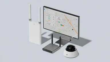
Since launching the GC31-E last year, we’ve seen many schools and transit authorities use our cellular gateway to extend AI-powered video security to their buses. Paired with our hybrid cloud cameras, the GC31-E enables staff to reliably view footage from any vehicle — remotely and at any time.
Today, we’re introducing two features to help these organizations investigate and respond to incidents faster: GPS video search and cellular coverage maps.
GPS Video Search
Having installed Verkada across 160+ buses in Clovis Unified School District, Chief Technology Officer Raj Nagra shared an important insight with us: in vehicle investigations, the location of an incident is often the most useful search attribute. Oftentimes, bus drivers and parents know where an incident happened but not when.
To address this, we partnered with Raj and his team to develop GPS video search. This feature lets users trace a vehicle’s route within a time window, select a location on the route, and instantly access all associated footage. Once the footage is found, it can be used like any other video in Command: archived, added to incidents, or shared with stakeholders.
Even when staff aren’t sure which vehicle captured an event, they can use GPS video search to look across multiple routes. Users can view all vehicles that passed through the location of interest during a time window and quickly identify the correct video.
As Raj explains, “A parent might call and say, ‘Something happened at the corner of Herndon and Fowler today.’ Now we can go straight to that intersection and find out which bus was there and what happened.”
Beyond schools and transit authorities, law enforcement can also leverage GPS video search to aid incident response and investigations. With just a location and timeframe, officers can pull up every bus that was near a crime scene and retrieve visual intel or evidence from the cameras.
With GPS video search, school staff, transit authorities, and law enforcement no longer need to scrub through footage using vague clues. They can pinpoint the right recording in seconds, saving time and enabling faster incident resolution.
Cellular Coverage Maps
A frequent challenge with vehicle deployments is fluctuating cell coverage along their routes. Now, customers can use the GPS history map to visually display the connection quality throughout each vehicle’s trip. This helps administrators easily compare carriers or troubleshoot connectivity issues.
The Verkada data plan makes it even simpler to choose the most reliable network right out of the box. Armed with multi-carrier redundancy, customers can switch between major carriers with a click, test coverage along routes, and now visually compare performance to pick the best option.
And thanks to Verkada’s hybrid cloud architecture, customers don’t have to worry about poor cell coverage compromising footage along a route. Verkada cameras record locally and automatically upload video to the cloud once the vehicle reaches a location with better connectivity. The result: reliable access to the high quality footage and greater confidence in every investigation.
Availability
These new features will be available starting October 9, 2025. To learn more, please reach out to your Verkada sales representative or email [email protected].


